
MONSOON 2021 BEGINS AMIDST FAVORITE PACIFIC, NEUTRAL IOD, WINDY TENABLE.

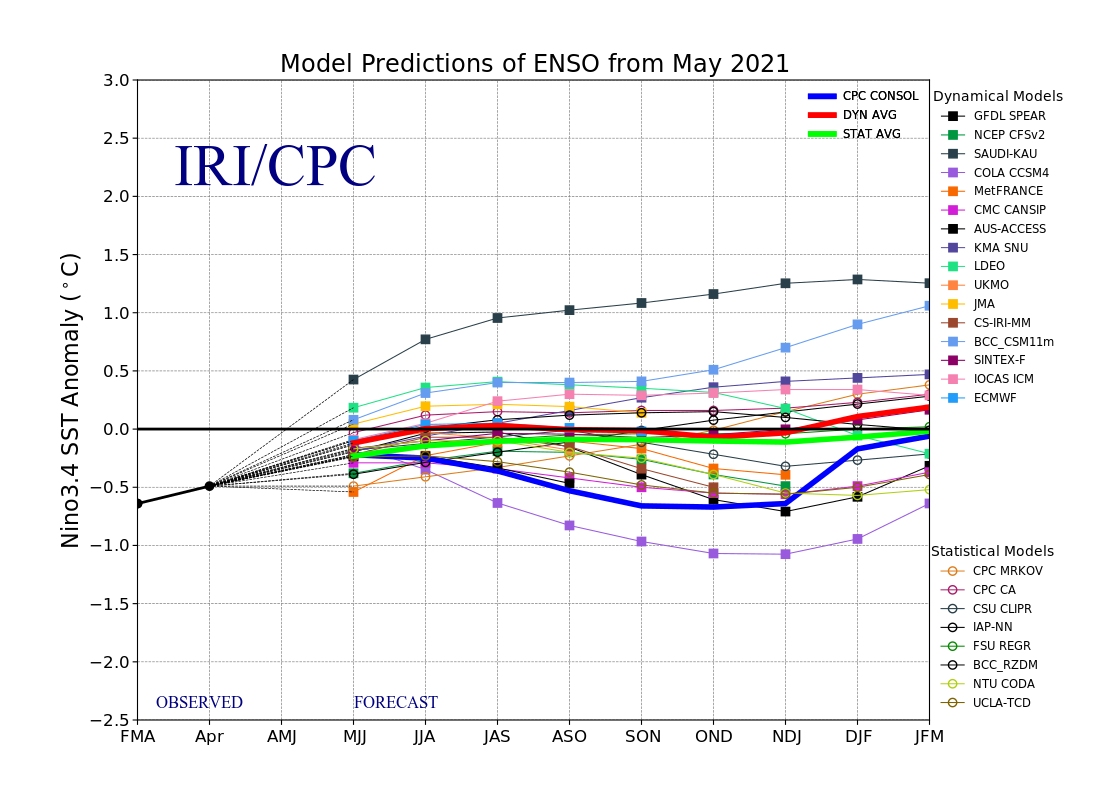
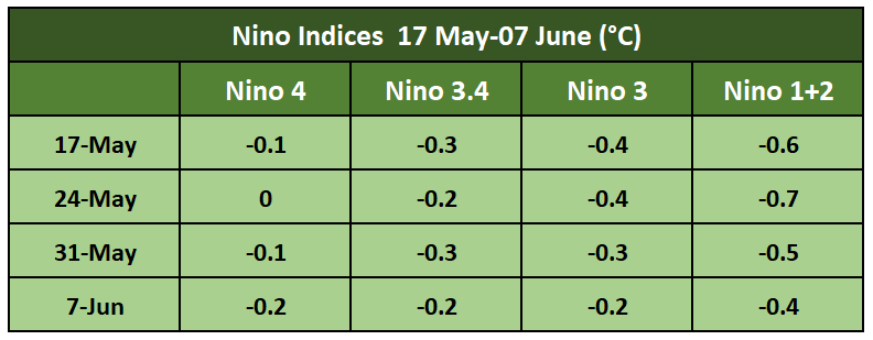
ENSO phenomenon contributes significantly to seasonal climate fluctuations in many regions of the globe and the southwest monsoon is the largest of all in size and duration. During the last 4 weeks, SST’s (Sea Surface Temperature) returned to near average across most parts of the equatorial Pacific Ocean.

Indian Ocean Dipole is defined by the difference in SST’s between the eastern and western tropical Indian Ocean. The IOD is neutral now. The latest weekly value of the IOD index to 06 June was -0.65°C, the 3rd consecutive week below the threshold of -0.4°C.

While a -ve IOD event is not declared until the index remains below the threshold for at least 8 weeks. It is to be kept in mind that -ve IOD does not offer support to the monsoon performance.
It may be noted that model accuracy during early June is still relatively low for IOD forecast. Model accuracy will improve significantly by end of the month.

Intraseasonal variability in the atmosphere, which is often related to the MJO, can significantly impact surface and sub-surface conditions across the Pacific Ocean. It also means that passage of MJO can bring about changes in the temperature profile of ocean surface and in turn the Nino indices.

Next 2 weeks, the MJO will meander in Phase 1, 2 and 3 over the Indian Ocean, albeit with marginal amplitude, but still good enough for accentuating convection over the Bay of Bengal.


0 Comments